by Tom Chillemi –
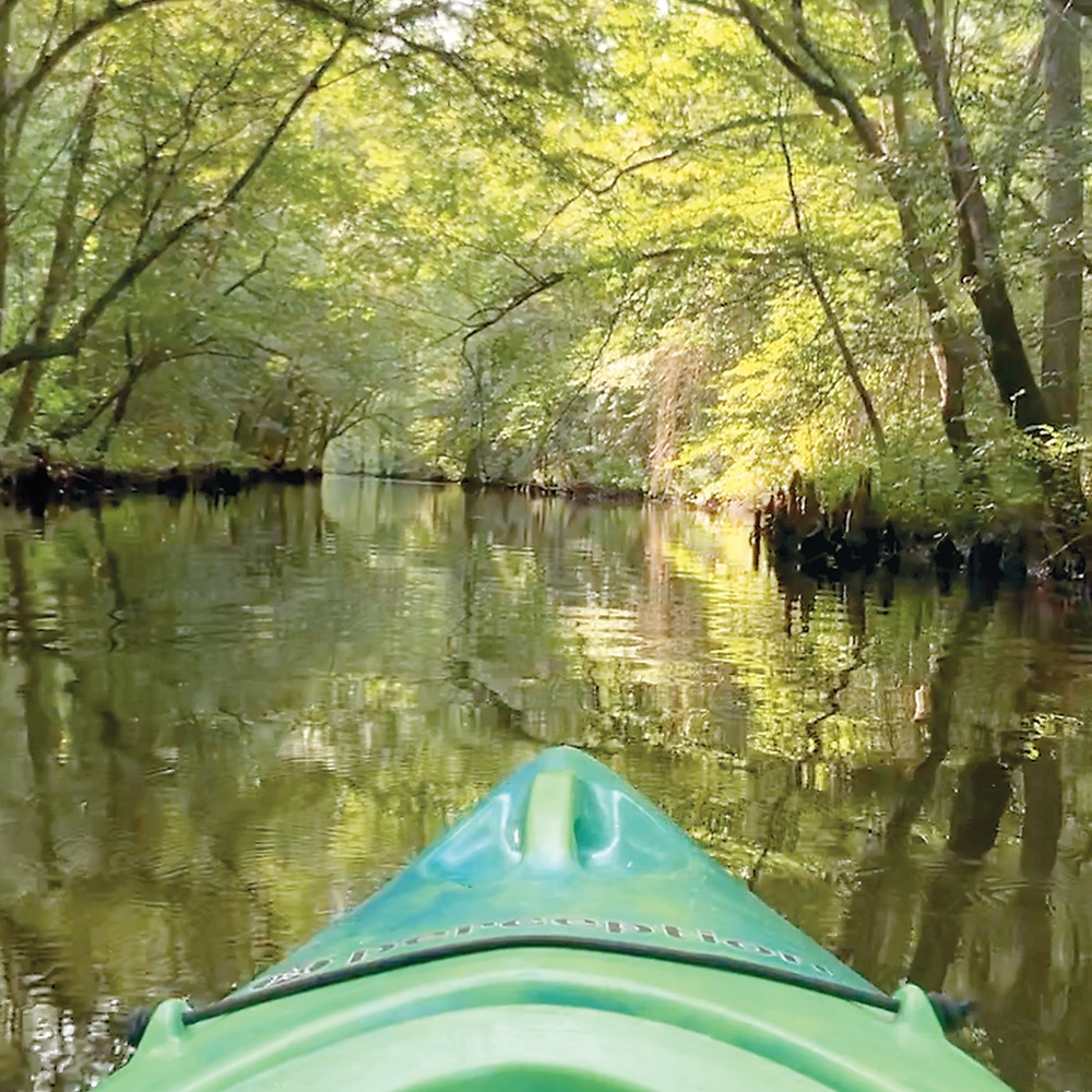
I push off from shore, breaking gravity’s bond. On a thin layer of water I float away from reality and into a magical world that humans can only visit.
The instant my kayak floats I know I am “there,” where I want to be — free from the land and the problems that stay on shore.
The lazy stream takes over as I fall under the spell of the Dragon Run.
If there is a more enchanting place in Rivah country, I haven’t found it.

Yellow Pond-lily or common spatterdock (Nuphar advena) is a member of the Water-lily family and is scattered throughout the Dragon Swamp as well as in other slow moving waters of eastern North America. The large heart shaped floating or erect leaves and yellow flowers poke above the water surface for a beautiful mix of green and yellow. Turtles, beavers, and wood and black ducks are reported to feed on it as well as numerous insects including its pollinators, at least one bee (Lasioglossum nelumbonis) and two semi-aquatic beetles, the false longhorn leaf beetle (Donacia piscatrix) and the waterlily leaf beetle (Galerucella nymphaeae).
My kayak glides effortlessly on the water’s slippery surface, dipping a paddle only to maneuver. Waving underwater plants hypnotize. They sway softly moving in unison to the water’s invisible force. When my paddle interrupts the water’s flow, the long green leaves gyrate in swirling eddies and then revert to their slow, rhythmic pulses.
Paddling forms funnel-shaped eddies in the water that spin briefly, pulling leaves into the circle, then dissolve.
Songs of birds brighten the clear air. Geese honking echoes. Ducks scurry overhead. A woodpecker hammers a craggy old tree. Water trickles over a beaver dam with a soothing tinkle.
A bug buzzes by. The hum of its wings trails off like a speeding race car whizzing by. Nary a sound from the industrialized man-made world beats in this pristine world. So close, yet so far away. Just a few miles from the four lanes of U.S. 17, this magical place called Dragon Run passes days in quiet solitude. Time is measured by the flow of freshwater that slowly winds 40 miles until it meets the Piankatank River.
Delicate
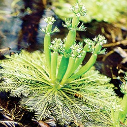
Featherfoil (Hottonia inflata), a member of the Primrose family, is habitat specific. It’s found along the coastal plain from Maine to Texas but only in still waters of swamps, millponds, and such. Although rare in much of its range, it flourishes in the Dragon Swamp. It’s rooted beneath the water and the leafy parts float atop the water, looking much like a candelabra. The white flowers are tiny but exquisite.
Somewhere up north springs release ground water that combines with rain water that is the twisting Dragon Run. It forms the border of King and Queen County to the west and Essex and Middlesex counties to the east. During the Civil War, the Confederate government called for all Virginia court records to be sent to Richmond for safekeeping. Instead Middlesex County officials hid court documents in the Dragon Swamp. Protected by a water and wetland maze, the county records escaped the destruction of Richmond.
In the pristine Dragon Run nature reigns. This swamp is suited to primitive life. Mammals are few. Reptiles, insects and the lower forms of life thrive in this temperate soggy jungle.
Largely undisturbed by humans, its ecosystem remains as it has been for thousands of years. The sounds of the modern world are barred, replaced by song birds and the trickle of water over beaver dams.
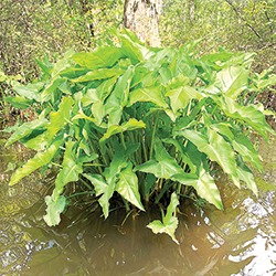
Arrow arum, or Tuckahoe (Peltandra virginica), is a member of the Arum family and a dominant plant in the marshes and swamps of the coastal plain including Dragon Run. It contains calcium oxalate, a chemical irritant found in thousands of plants, which provides protection against being eaten. Research does suggest though that wood and black ducks and muskrats are among the few species that feed on it. Tiny flowers are enclosed in a curled leaf-like structure called a spathe. The large arrow-shaped leaves rise above the water in a clump.
Peepers peep at people as they pass. Hidden by camouflage they blend into water and leaves. Mighty bald cypress trees scrape the sky. Their wood has long been prized for its resistance to decay. Eagles nest in their towering tops. Bald cypress knees shoot from the water, their cone shapes resemble hooded hobbits in long robes. They appear to be staring back at paddlers. Some believe cypress knees can move but they freeze when they hear humans approaching their domain then come back to life after people pass. The water holds mystical elements such as underwater formations that appear to be solid. What looks like sunken wood turns out to be a “mermaid hair” and dissolves before your eyes as in a dream.
It’s a place frozen in time where nature reigns and humans are outsiders.
The Dragon Run is a hard place to leave. And time spent there goes by quickly, making the experience all that more precious.
Trying to tame the Dragon Run
In the 1840s, the Dragon Swamp Navigation Company attempted to tame the twisting Dragon Run. A barge canal was built from the Piankatank to the “New Dragon Bridge” at Mascot, according to a Virginia Canals Navigation Society publication, The Rappahannock Scenic River Atlas, by W.E. Trout III.
Cypress feathers
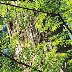
The bald cypress trees drop all their needles each winter. In the spring, their new needles resemble feathers.
This canal was built for “lighters,” which were square barges 45 feet long and 10 feet wide with a draft of less than two feet.
A modern bridge has replaced the original one and is on Farley Park Road (Route 603) and is the border between Middlesex and King and Queen counties.
This is the location of the Mascot access point to the Dragon Run. Paddlers can put in and explore the immediate area, but paddlers are strongly cautioned to not attempt to travel lengths of the Dragon Run. Guided paddles are offered by the Friends of the Dragon Run (see related story).
At the access point there also is a nature trail through the woods bordering the Dragon.
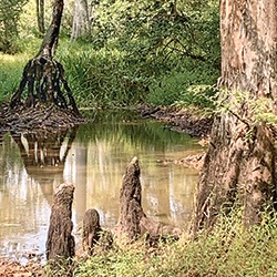
Bald cypress knees shoot from the water, their cone shapes resemble hooded hobbits in long robes. They appear to be staring back at paddlers. Some believe cypress knees can move but they freeze when they hear humans approaching their domain then come back to life after people pass.
Trout wrote there is another canal, at mile 13, that is .6 of a mile long and about 50 feet wide “bypassing a torturous part of the Dragon.”
At mile 8.5 there was a .1 mile canal, about 12-feet wide, that is documented on a 1937 map and was still navigable in 1992, when Trout published his findings.
The canals were built for navigation, to float timber to sawmills and to drain crop land, wrote Trout.
Thomas W. Fauntleroy, president of the Dragon Swamp Navigation Company, chose the name for the village of Saluda, which means “healthful,” after he visited relatives who lived on the Saluda River in South Carolina, according to the book “River and Roads of Middlesex County, Virginia.”


