Interesting history surrounds Mathews County landmark
The world once moved by wind on water.
As a new nation was forming in America, ships needed help with navigation of Chesapeake Bay.
Congress authorized building lighthouses in 1801 and on Jan. 17, 1805, the New Point Comfort Lighthouse beamed from the southern tip of Mathews County, where the Chesapeake and Mobjack bays meet.
For the next 158 years, with few interruptions, it was an official aid to navigation — first by the amplified light of a flame, and later it was automated. It went dark in 1963 when the U.S. Coast Guard abandoned the stone tower.
New Point Comfort Lighthouse’s next life began in 1975 when Mathews County acquired it. Through efforts of local folks and federal grants, the ravages of wind and water were staved off.
Huge stones were placed around its base to stop sand from washing away.
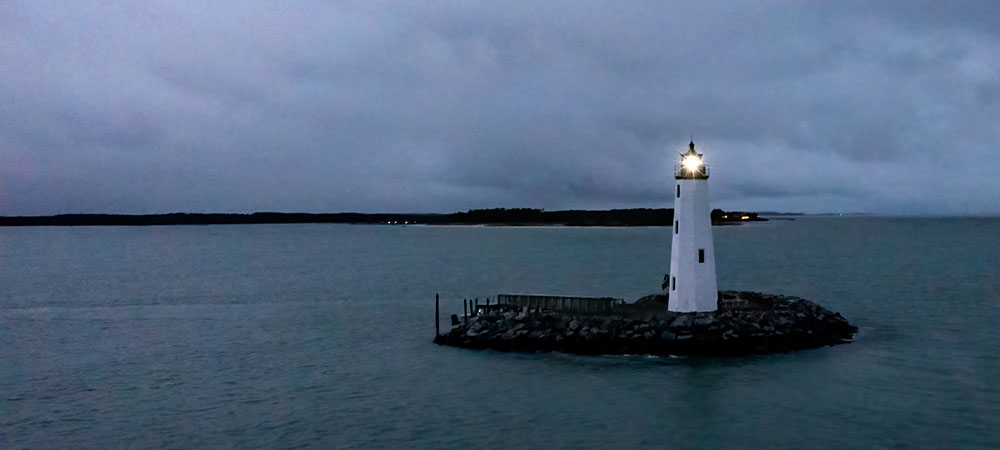
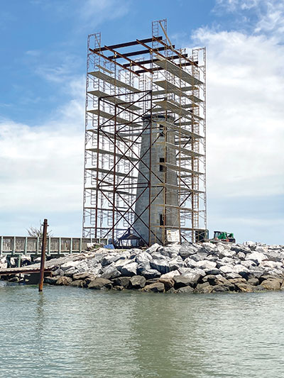
In 2021 a major renovation was completed and today a light shines again from atop the structure that is the third oldest lighthouse on Chesapeake Bay.
It’s a story of perseverance against the odds . . . and the relentless forces of nature.
The location named “Newe Poynt Comfort” appeared as early as 1650 in the Colonial records of the area distinguishing it from Old Point Comfort at the tip of Virginia’s Eastern Shore.
Jamestown, the first permanent English settlement in the new world is on the James River, a short distance to the south of New Point Comfort.
A 1623 map of Captain John Smith named the southern tip of what would be Mathews County’s “Point Warde,” after an investor in the Virginia Company, William Warde, who had accompanied Smith on his voyage discovery of the Chesapeake Bay in 1607-1608.
The island
In 1801, the site for the lighthouse was chosen on an island at the southern tip of Mathews.
On March 3, 1801 the second United States Congress authorized construction of a lighthouse at New Point Comfort. Elzy Burroughs, a stone mason, was awarded the contract to construct the lighthouse. The Aquia sandstone for its base was gathered from the same Virginia quarries that provided material for Mount Vernon, the U.S. Capitol Building, and the White House.
Burroughs was appointed the first keeper of the lighthouse by President Thomas Jefferson. The lighthouse went into operation on Jan. 17, 1805.
Just two years earlier in 1803, Burroughs had completed most of the work on the Old Point Comfort Lighthouse at the mouth of the James River at Chesapeake Bay. It still stands 54 feet high.
The Old Cape Henry Lighthouse, built in 1792, is the oldest lighthouse on the Chesapeake Bay and the third oldest still standing in the United States.
War
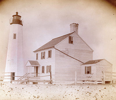
In the War of 1812, the British ransacked the lighthouse and burned the lighthouse keeper’s house. In a letter from Christopher Tompkins of Mathews to Charles K. Mallory collector of customs in Norfolk dated March 25, 1814, Tompkins wrote, “. . . they have also broken every pane of glass in the Lanthorn (lantern), taken out and carried off all the window frames, also the door and frame from the Light-House. … At all events I would not advise the repairing (of) the Light House where it now stands as the water already washes its base, and in a few years will undermine it – indeed it was very improperly placed at first …”
During the Civil War, Confederate militia disabled the lighthouse so that it could not be used as an aid to navigation by the Union navy. Chesapeake Bay is its narrowest here.
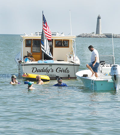
It’s about 14 miles between New Point Comfort and the Town of Cape Charles on the Eastern Shore. And this stretch of water was where the Union navy formed a blockade.
Dreamers
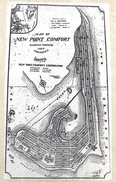
The May 1, 1904 Baltimore Sun newspaper reported that a company planned a resort at New Point Comfort with steamboats to stop there. Their plans included a new steamboat line that would go from New Point Comfort to “Cape Charles City,” which is about 15 miles east across Chesapeake Bay, where travelers could connect to railroads running to New York in Pittsburgh.
On June 8, 1904 Baltimore Sun reported that the company planned to build a railroad line from New Point Comfort to the Piankatank River and then to West Point, which was the terminal of the Richmond and York River division of the Southern Railway. The idea was to shorten the trip from Baltimore to Richmond by five hours as steamboats had to follow the James River all the way to Richmond.
The grand plan failed financially and the New Point Comfort Development Company went bankrupt. No matter, whatever was built would have been decimated by the Great August Storm of 1933. The hurricane sent 12 foot high walls of water against the local shores.
“The old New Point Comfort wharf is no more, nothing left but a few pilings,” wrote the Mathews County Historical Society 1982 in its “History in progress-Mathews County Virginia.”
The Mathews Journal newspaper on July 2, 1931 reported that a ferry had been established from Bayside to New Point Comfort Beach. “Thousands of people go to New Point Comfort in summer and there’s no better bathing place anywhere with a hard clean bottom and clearwater free from sea nettles.”
In 1976 Mathews County acquired the lighthouse property and that was shored up with 16 tons of armor stone riprap to check the erosion at the base, according to the Mathews County Historical Society.
Grassroots effort
Through the effort of local folks like the Mathews County Historical Society, working with the Mathews County government, the lighthouse’s island was preserved.
 By 2002 the Preservation Alliance of Virginia placed the lighthouse on its list of most endangered structures.
In 2006 the U.S. Army Corps of Engineers denied protection of the lighthouse and nearby habitat restoration.
Things turned around in 2009 and 2010 when grants were received that saved the tiny island on which the lighthouse was standing. It would take more than 10 years for the New Point Comfort Lighthouse to get the money needed to restore it to its former glory.
Today it is a sentinel, marking the past, and guiding mariners again.
(Note to readers: Some of the timeline for this story are excerpted from “New Point Comfort Lighthouse, its History and Preservation” by Mary Louise Clifford and J. Candace Clifford, published in 2013 by the Mathews County Historical Society. Additional facts were drawn from “www.newpointcomfortlighthouse.org,” which features a slide show of historic photos.)
